How might we design a bridge that is able to withstand everyday use and survive a flood defined by the 500 year flood prediction?
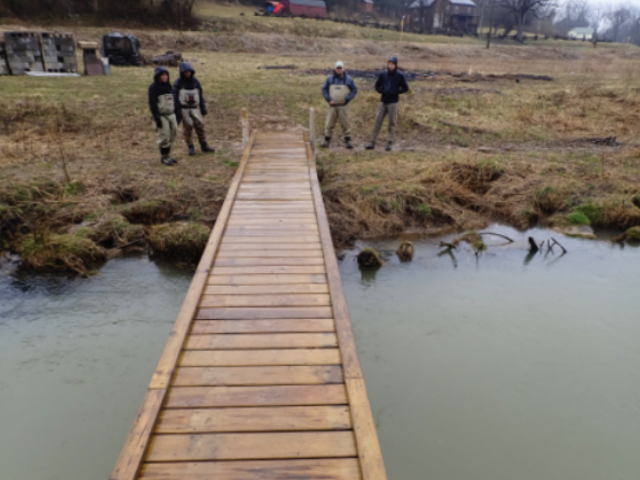
Bridge over Mossy Creek
A series of pedestrian bridges in the Mossy Creek area in Mount Solon, VA, were washed away after historic flooding in May and September 2018. There is a need to rebuild the bridges so that community members and visitors can access both sides of the creek's banks, specifically for the creek's primarily recreational activity of fly fishing. To respond to this problem, seven engineering students, including myself, joined a special projects class coordinated by three engineering faculty members at James Madison University (JMU). In this class, I engaged with community stakeholders, developed a preliminary design of a bridge, and researched stabilization techniques of the streambed that can protect a new pedestrian bridge and trout habitat during future flood events. During this engineering process, I sought to understand the partnership among Trout Unlimited (a non-profit), the private landowners, and the VA Department of Game and Inland Fisheries (DGIF). In that partnership, there are posted restrictions against wading through the environmentally sensitive creek to prevent contaminants and invasive species from entering and harming the creek's ecosystem.
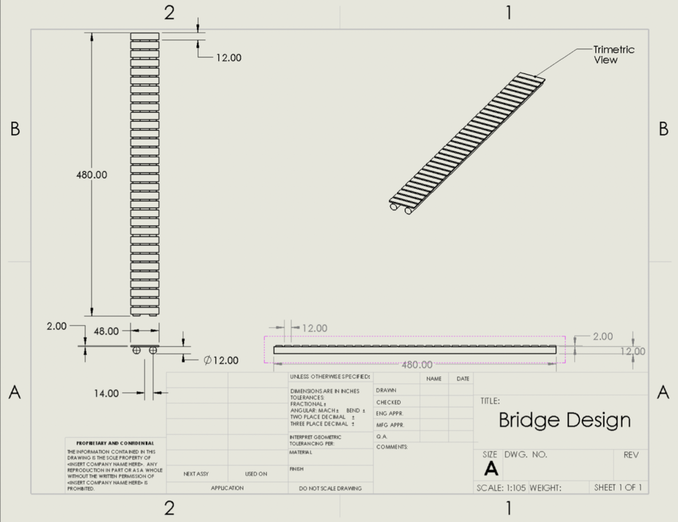
Within this project, I mapped the flooding events in the area using ESRI ArcGIS so that the bridge that is constructed is able to withstand future flooding. This flood mapping included a FEMA floodplain for a 100 year flood and a green pin point where the bridge is located along the creek. After this, I created engineering drawings of different scenarios of bridge flooding and loads, as well performed an analysis relating these two concepts quantitatively. The engineering drawings me to practice my Solid Works skills, as well visualize the bridge design that would be the most effective for this specific situation. A large aspect of this project revolves around visualizing the potential bridge in order to accurately determine what materials will be needed. The engineering drawing created from this Solid Works model displays views from the top, right and front planes. Each face also shows the dimensions for each piece to provide a clear idea of how to construct the bridge. The drawing displays 32 planks across a 40ft span to support the individuals using this bridge, with two long, cylindrical supports below that each have a diameter of one foot and are 28in apart. By seeing this bridge in this more formal sense we are able to evaluate where it is weaker and would need to be changed and strengthened. Additionally, I explored the selection of materials for the new bridge. Wood is being explored because of the notion that the material provides buoyancy against the rising creek waters in the case of a flood. This buoyancy is being explored as a possible advantageous feature to design the bridge to disconnect from one of its supports during a future flood event and rotate about its remaining support in a controlled manner. Along with two other engineering students and three engineering faculty members, I wrote and published a technical paper which outlined the project that was being worked on, as well as education being a factor in having students build the bridge.